Precision agriculture involves the observation, impact assessment and timely strategic response to fine-scale variation in causative components of an agricultural production process.
Therefore, precision agriculture may cover a range of agricultural enterprises, from dairy herd management through horticulture to field crop production. The philosophy can be also applied to pre- and post-production aspects of agricultural enterprises. With this definition in mind, the Precision Agriculture Laboratory is presently focused on applying precision agriculture to field crop production. The term ‘site-specific management’ (SSCM) describes this facet of precision agriculture.
What is site-specific crop management?
Site-specific crop management is a form of precision agriculture whereby decisions on resource application and agronomic practices are improved to better match soil and crop requirements as they vary in a field.
Collectively these actions are referred to as the ‘differential’ treatment of field variation as opposed to the ‘uniform’ treatment that underlies traditional management systems.
The five main components for a site-specific management system are illustrated as follows:
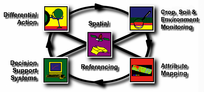

Spatial referencing
The ability to geo-reference data, i.e. link it to a specific location on the Earth’s surface, is the truly enabling technology of SSCM. Global Navigation Satellite Systems (GNSS), of which the GPS is the most widely used at present, are now employed on many farms. A range of accuracy (from metres to centimetres) is available across Australia.
GNSS are commonly used in agriculture for:
- crop and soil testing;
- crop yield and quality monitoring;
- remote and proximal soil and crop sensing;
- terrain modelling;
- variable-rate application (VRA) of inputs; and
- vehicle navigation systems (guidance and autosteer).
A reasonably detailed and easy to understand explanation of the role and operation of the GPS and other Global Navigation Satellite Systems is available on our educational resources page.
Decision support systems:
Examination of the spatial variability determines whether unique treatment is warranted in areas of the field. Knowledge about the effects of field variability on crop growth, and the suitable agronomic responses, can then be combined to formulate differential treatment strategies.
- initial attempts have adapted existing agricultural DSS to site-specific situations;
- ultimately, DSS that are able to site-specifically model plant-environment interactions in terms of yield and quality will be needed; and
- these will need to be flexible enough to incorporate a variety of sensor-gathered data (historical and real-time) and accept feedback from other parts of the SSCM cycle.

Crop, soil and environmental monitoring:
Many sensors and monitors already exist for in-situ and on-the-go measurement for a variety of crop, soil, landscape and environmental variables. Technological development continues to increase the range of cropping attributes measured in real-time and at high spatial densities.
Such sensors are commercially available for :
- yield and quality;
- crop reflectance for biomass, vigour and stress;
- soil apparent electrical conductivity (ECa), natural gamma radiation emission, reflectance and pH; and
- elevation.

Differential action:
A management operation that uses more than one level of treatment or action. The use of differential management requires information on where, and by how much, actions should be varied. Differential management does not necessarily require variable-rate technology (VRT).
Differential treatment options include:
- variable-rate application (VRA) of inputs;
- variable type or mix of inputs;
- variable placement; and
- variable timing of inputs.
More introductory information about precision agriculture and site-specific crop management can be found on our educational resources page.
Attribute mapping:
Crop, soil and environment sensors produce large, spatially dense data sets. The observations are usually irregularly spaced and need to ‘cleaned’ and mapped onto a continuous surface to permit analysis.
- High quality maps are made using reliable data and robust mapping techniques.
- The continued development of PA software and Geographical Information Systems (GIS) specifically designed for agriculture is making this task easier.